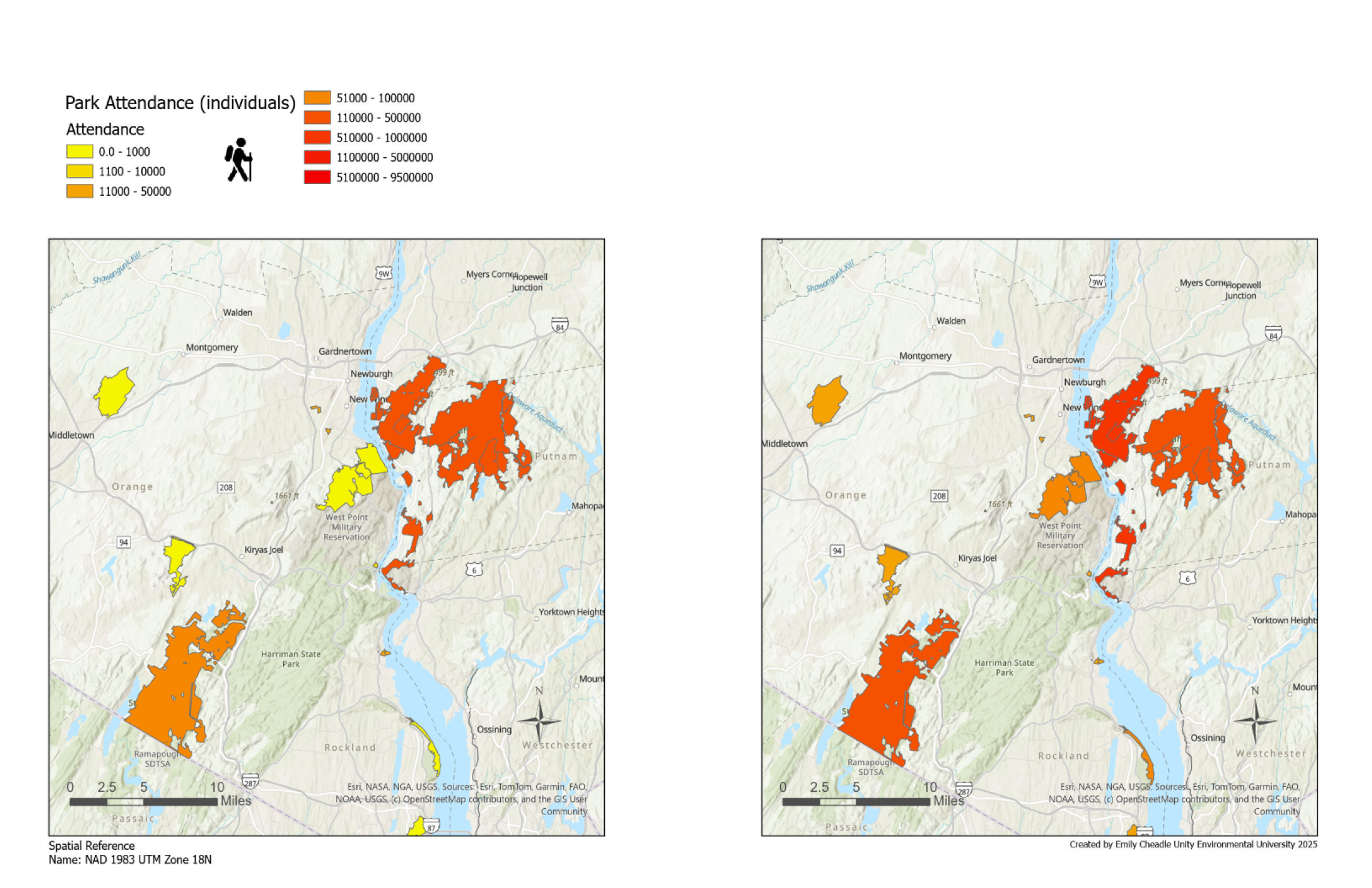
Maps shouldn’t just be static pictures—they should be tools people can explore.
I specialize in web mapping tools that connect people to place.
My projects include participatory mapping platforms, conservation dashboards, and interactive story maps that help communities and organizations visualize data, share local knowledge, and make collaborative decisions.
By combining GIS with web technology, I ensure that spatial data is accessible, intuitive, and impactful.