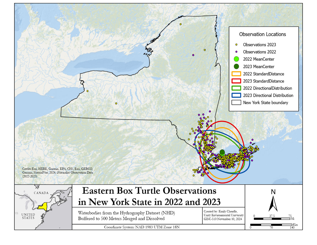
Spatial analysis is about more than maps; it’s about understanding how places work.
I use advanced spatial analysis techniques to uncover patterns, relationships, and trends hidden in geographic data. From conservation planning to community walkability studies, I deliver results that inform strategy and support evidence-based decisions.
I help communities, governments, and organizations use GIS to answer key questions: Where are the best opportunities for new trails? How connected are our protected lands? Where are gaps in accessibility? My analyses turn complex data into clear guidance for smarter planning.